
Water Resource Intelligence
Optimize water management and conservation with comprehensive monitoring
Solution Highlights
Comprehensive Water Resource Intelligence
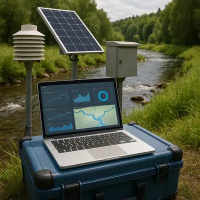
Our Water Resource Intelligence solution provides comprehensive monitoring of water bodies, drought prediction, and irrigation optimization across Africa. Using satellite data and AI analysis, we help governments, agricultural organizations, and water authorities make data-driven decisions for sustainable water management.
By combining optical and radar satellite data with hydrological models, we deliver insights on water availability, quality trends, and flood risks to support climate-resilient water resource planning.
Powered by Advanced Technology
Built on cutting-edge geospatial technology stack optimized for African environments
Multi-Source Satellite Data
Sentinel, Landsat, MODIS integration with automated pipelines
AI & Machine Learning
Deep learning models specifically trained on African environmental data
Cloud Infrastructure
Scalable AWS/Azure processing with 99.9% uptime guarantee
Real-time Analytics
Live monitoring, alert systems, and API integrations
See It In Action
Experience the power of our platform with an interactive demo
Interactive Platform Demo
See real data processing and insights generation
Proven Success Stories
Real-world implementations delivering measurable impact
Machakos County Implementation
Reduced water allocation conflicts by 60% through real-time monitoring and predictive analytics.
Conservation Partnership
Early detection of deforestation activities with 90% accuracy, enabling rapid response.
Transformative Benefits
Improved water resource planning and allocation
Early drought warning for proactive management
Optimized agricultural water use and efficiency
Flood risk mitigation and preparedness
Sustainable water management practices
Climate-resilient water infrastructure planning
Enterprise Use Cases
Trusted by leading organizations across multiple sectors
Water Resource Authorities
Manage water allocation and implement conservation strategies
Agricultural Cooperatives
Optimize irrigation schedules and reduce water waste
Disaster Management Agencies
Predict and respond to floods and droughts with early warnings
Urban Water Utilities
Monitor reservoir levels and plan for water supply
Choose Your Plan
Scalable solutions for organizations of all sizes
Starter
Perfect for small teams
Professional
Ideal for growing organizations
Enterprise
For large-scale deployments
Ready to Deploy Water Resource Intelligence?
Join leading organizations across Africa leveraging our premium geospatial intelligence solutions. Schedule a personalized demo to see how Water Resource Intelligence can transform your operations.
Average implementation time: 2-4 weeks • Enterprise support included