SpatioNEX AI-powered geospatial intelligence visual for climate resilience in Africa
Powered by SpatioNEX

Shaping the Future with Geospatial Intelligence
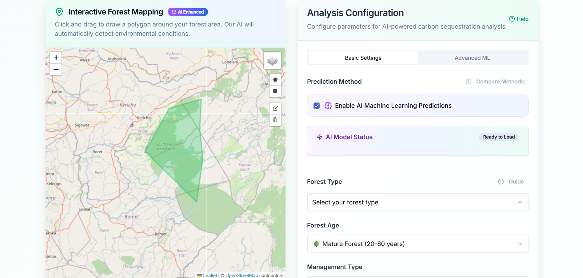
SpatioNEX harnesses AI-powered satellite and GIS data to deliver actionable insights, helping Africa achieve climate resilience, protect ecosystems, and make informed policy decisions.

African-Built Innovation

Tailored to local challenges and contexts

90% Monitoring accuracy

In environmental monitoring

Our solutions are designed to support policy decisions, climate resilience strategies, and sustainable development efforts.

Government Agencies
Regional Environmental Initiatives
Research Institutions
Non-Governmental Organizations
Climate Resilience Projects
Urban Planning Authorities
Sustainability Networks
Development Programs
Government Agencies
Regional Environmental Initiatives
Research Institutions
Non-Governmental Organizations
Climate Resilience Projects
Urban Planning Authorities
Sustainability Networks
Development Programs

Discover SpatioNEX Platform

Explore our AI-driven geospatial tools and learn how we're providing practical insights for environmental monitoring and decision-making across Africa with innovative tech and tailored solutions.

Latest Insights

Stay updated with our latest research, case studies, and insights on geospatial intelligence and climate resilience.

Radar Remote Sensing for Agricultural Applications.
SpatioNEX Team

Radar Remote Sensing for Agricultural Applications.

Join SpatioNEX for a power-packed webinar on “Radar Remote Sensing for Agriculture Applications.” Learn how SAR is transforming crop monitoring and climate-smart farming.

Why Africa Needs GeoAI Now: The Race to Build Climate-Resilient Intelligence Systems
Clement Ndome

Why Africa Needs GeoAI Now: The Race to Build Climate-Resilient Intelligence Systems

Africa’s greatest climate challenge isn’t lack of data; it’s lack of intelligence. SpatioNEX is building the next generation of AI-driven geospatial systems to turn Earth observation

Introducing SpatioNEX: Building Africa’s Next Generation of Geospatial Intelligence
admin

Introducing SpatioNEX: Building Africa’s Next Generation of Geospatial Intelligence

SpatioNEX is redefining how Africa leverages AI, GIS, and remote sensing to tackle climate resilience, natural resource management, and urban development challenges.

Unlock Actionable Geospatial Insights with SpatioNEX

Discover how SpatioNEX's geospatial intelligence can empower data-driven resilience for governments and organizations in Africa. Let's explore the possibilities together.