FLOOD MAPPING AND IMPACT ASSESSMENT
FLOOD MAPPING AND IMPACT ASSESSMENT
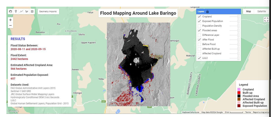
This project demonstrates the application of satellite Earth Observation and machine learning technologies for rapid flood detection, exposure assessment, and disaster impact analysis.
Using Synthetic Aperture Radar (SAR) imagery, optical satellite data, and cloud-based geospatial processing, the system supports near-real-time identification of flood extent and assessment of impacts on populations, agricultural land, and infrastructure.
Developed using Google Earth Engine and machine learning techniques, the solution enables rapid generation of actionable spatial intelligence to support emergency response, disaster preparedness, and environmental monitoring.
Key capabilities include:
- Automated flood extent mapping
- Satellite-based change detection analysis
- Exposure and vulnerability assessment
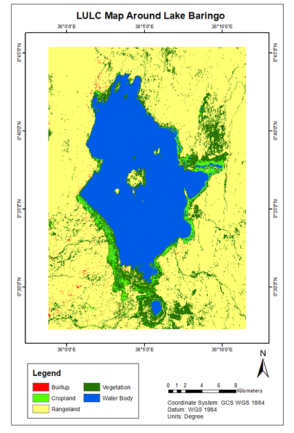
- Land use and land cover impact analysis
- Population and infrastructure risk estimation
- Interactive geospatial visualization
This approach demonstrates how Earth Observation can support disaster risk reduction and climate resilience initiatives.
Ready to Start Your Project?
Let's discuss how we can apply our geospatial intelligence expertise to your environmental monitoring and climate resilience challenges.