Secure Geoportal for Automated Survey Quality Assurance and Data Management
Secure Geoportal for Automated Survey Quality Assurance and Data Management
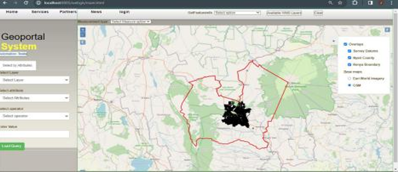
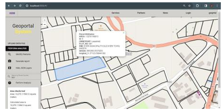
Geoportal Web Interface – Nyeri Municipality
The Secure Geoportal for Automated Survey Quality Assurance and Data Management is a a secure web-based geospatial information system designed to modernize land survey operations, automate quality assurance processes, and improve spatial data governance.
Built using open-source geospatial technologies, the platform provides centralized management of survey datasets, automated validation workflows, and interactive spatial analysis tools within a secure digital environment.
The system supports:
- Centralized spatial data management
- Automated survey quality assurance workflows
- Interactive geospatial visualization
- Parcel identification and verification
- Spatial querying and analysis
- Distance and area measurement tools
- Historical survey record retrieval
- Secure user access management
The platform demonstrates how digital geospatial infrastructure can improve operational efficiency, data integrity, and transparency in land administration and survey management.
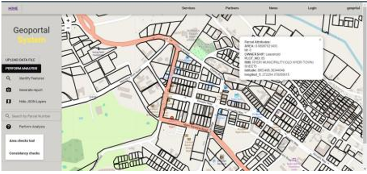
Identifier Tool
The Identifier Tool enables users to select specific parcels or features on the map and instantly view detailed attribute information. This function supports quick inspection of survey data and verification of land parcel details.
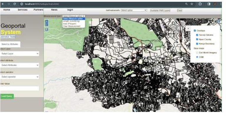
Measurement Tool
The Measurement Tool provides precise functionality for measuring distances and areas directly within the map interface. It enhances accuracy assessments, field validation, and general spatial analysis during survey workflows.
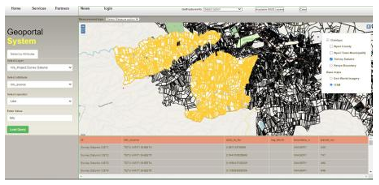
Spatial Query Tool
The Spatial Query Tool empowers users to perform advanced searches and filtering based on spatial relationships or attribute criteria. This feature allows efficient extraction of specific datasets and facilitates focused spatial analysis.
Computational Checks
The Computational Checks component performs automated data validation to identify inconsistencies or errors within survey datasets. This ensures data integrity, reliability, and conformity to set standards before approval or publication.
Conclusion
These integrated tools make Geoportal a comprehensive digital environment for survey quality assurance and spatial data management. The system enhances accuracy, transparency, and operational efficiency, supporting sustainable land administration and informed decision-making across Nyeri Municipality.
Ready to Start Your Project?
Let's discuss how we can apply our geospatial intelligence expertise to your environmental monitoring and climate resilience challenges.